1000km attempt San Joaquin Valley Wave Day
A January 2020 1000K attempt from Avenal
We agree to watch the forecast and let things firm up. I do block my calendar out at work just in case. I alert Jim Payne and Paulo Iscold about the possibility thinking that Jim may want to use Nixus for a flight. If not, I am hoping it will be available.
Then we wait. Will it improve, degrade stay on track?
Kemp: Morgan and I had known each other for years but never flew together. With many years of mentoring cross country pilots in each of our two seat ships, we were keen to figure out a time to fly this season. At my base at Williams, I look 16 days out for possible setups for long flights, then around 7 days out, start alerting other pilots to the possibilities. I’d been watching since early November for a wave day along the southern Diablos and Temblor range for a 1000K zig-zag. For Jan 16th the 700mb setup was near ideal, with 40kt winds at 11,000 ft. from 240.
Forecast has shifted. Now Wednesday afternoon is looking best. Kemp has the front speeding up and passing through mid morning on Thursday with rain early. Looks like this may not happen.
Kemp: Glider pilots enduring a forecast’s ups and downs is called “weather whiplash” 8^)
Narrowing in that my Duo is the most likely choice for this attempt. Nixus may be available, but requires more coordination, ground support, prep-work and timelines are already looking tight. Paso Robles isn’t showing any wave overhead and it is looking to be overcast and wet.
We are both thinking along the same lines for tasking at this point. It will be a yo-yo flight, that’s a given. We will press as far north on the first leg as we can. Probably Los Banos area and then when we hit the rain wall, we will turn south. The forecast on SkySight made it look as though stepping out into the Mojave and Antelope Valley might be realistic.
Forecast is still looking quite wet, but the front is slowing and we are seeing it move back towards Thursday, but wet. Rain on the ground at Avenal by 1:00pm per NWS. Still pretty unlikely that this is going to come together.
This is an exploration flight that Kemp wants to do. The theory says it should all work, but we need to connect the dots, figure out the jumps between wave systems, map out our options. So even if it is time limited due to wet weather, it’s worth a try. I email Dan Gudgel for a tow.
Kemp: With a 10 hour day, I propose a 625sm task:
Less than 24hrs out, the forecast on the ground looks uninspiring to me. Rain in the Avenal area by 1:00pm. West of Avenal looking like solid cloud cover. Valley getting a fair bit of rain (.25”+) and a strong front. I run a briefing in Foreflight for the intended route. Airmets galore. Mountain Obscuration, Turbulence (That’s actually a good one) and Icing. IFR along much of the route during the forecast time. Surface conditions in the afternoon are also forecast to be MVFR or IFR for most of the Valley. Great, let’s go.
I get confirmation from Dan that he is available to tow early on Thursday if we decide to go. He says the storm is going to come ashore harder than forecast though (and he will be proven right). This type of front intensifies as it approaches the coast and the Hanford NWS is under-predicting the rain amount. Hah, I thought the forecast as of Wednesday was wet and my valley weather god is telling me that it wasn’t pessimistic enough.
I’m scrambling to put out a few fires at work, shift some meetings and get home to pack up a few final things into the RV and get on the road with 5H in tow.
Kemp: Looking at the SkySight rain chart I’m thinking, “this isn’t so bad”. How wrong I'd be! For those new to wave weather, this is prefrontal wave, as we're taking advantage of the increasing winds ahead of the front, ideal for wave, while managing the risk of rain and the bad weather of the front itself. Ideally the front stalls in the morning to allow us steady, nice wave all day, but that clearly was not the case here.
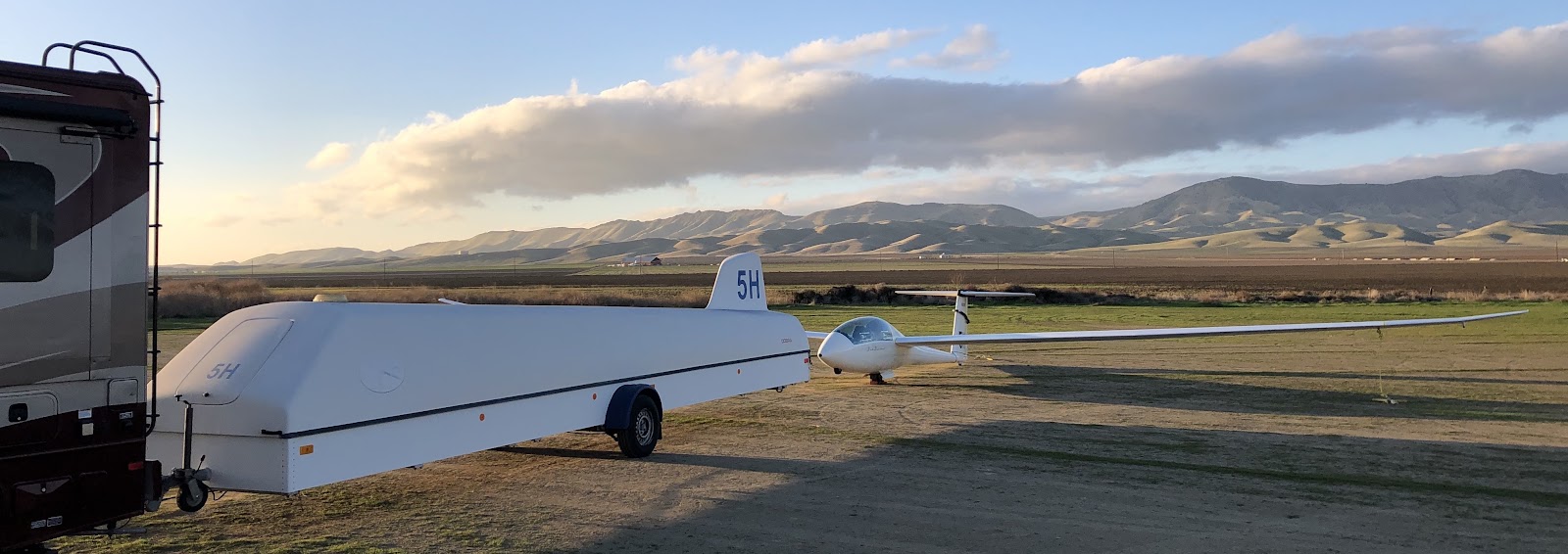
Morgan and I meetup finally at Paso Robles at 7:00pm as I drove from the north, and he from the south. We assemble at Avenal in calm conditions with Morgan remarking, ”it’s strange, how calm it is through the morning of a wave day here”. Well, the banging of the winds at 1:45am drove him to quickly re-secure the ship. Me, I slept through it 8^0
Morgan: Famous last words, “It doesn’t usually blow until mid morning…” After rigging, prepping and generally securing the glider, I moved on to prep the towplane for Dan. Fuel, oil, battery check, preflight and organizing a tow rope and the appropriate weak links. Everything I could do to ease the job on Dan and make things go quicker in the morning. We were hoping for a 7:10am launch or so.
Cue the rotor touching down at 1:45am rustling the trees and motorhome. The second gust was enough to convince me to better secure the glider. Out of bed and down to the trailer for extra tie-downs, elevator and rudder locks. Back to bed by 2:10am.
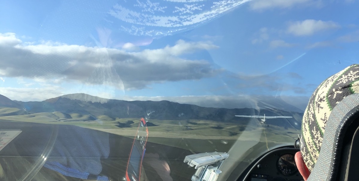
The clouds show it’s a super day, especially as the sun rises. The wind calms, so opening the hangar and prep is much easier. We move quickly as our luck may not last. I'm in back, Morgan in front as we tow off behind Dan in the 150 at 8:40am (click for video).
Almost immediately off the ground, the turbulence starts and gets worse, mostly seeing the side of the 150, along with a few stomach churning drops. A Minden class rotor experience! Thankfully it’s short as we release into 11+kts of lift (video). Poor Dan has to fight his way back down through the rotor. We only had to go through it once.
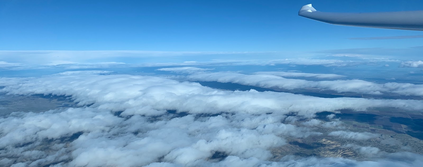
Our first downwind jump came 20 minutes after release at 11,400 ft. upwind of Coalinga. Beautiful bars set up over Los Gatos Creek (the valley that leads from Coalinga to Hernandez reservoir) and beyond the San Benito Mtns north of Coalinga. The line behind Wright Mountain looked really strong, but we wanted to mark the wave bar over Los Gatos Creek for reference.
A short dogleg on Los Gatos Creek and it was over the back towards the Idria Valley. This extended to Panoche with at least two more bars downwind towards the Panoche Hills and I5. Winds were in the 60-70kt range, but we managed 60kts+ over the ground most of the time.
Dropping back again near Mercey Hot Springs and we connected with the last bar which lead up to San Luis Reservoir and the rainwall of the front.
As we approached the turn, I couldn’t help but tease Ramy a bit knowing his FOMO (Fear Of Missing Out) meter was off-scale. Typically the rest of the flying community is watching Ramy extracting the most out of a day midweek while we tend to work. Thankfully InReach messages allow a few jabs from 14,000 ft. when data coverage is spotty.
Turning south (video) we retraced our steps as the wave bars built stronger out in front of us towards Coalinga. With the approaching front, the wind strength was increasing and the bars shifting further downwind.
The jumps upwind (video) were expensive. With as much as 70kts on the nose it cost 4,000 ft to cross the sink and clear the top of the wave bar to reach the lift. We were always looking out 10-20 minutes down our flight path. Where we’d cross, what looked strong, where were the bars highest or with the steepest leading edge.
Our goal was to fly as fast as possible, but reaching our next jump point at 16,000 ft or so in order to have adequate altitude to cross. That’s the guesswork and math problem you’re continually working out. How fast can I fly so I don’t have to stop.
In general, we were typically on the same page. Looking towards the same features in the wave for the jump. Bridges connecting wave bars, channels in the clouds, anything that indicated a potential energy line. Kemp definitely got me flying faster than I’m used to. With such strong lift and winds we were often running at 100kts or more which is well above the point where the Duo polar drops off a cliff.
Nearing Harris Ranch and Coalinga, we had two jumps to make to get back to the primary. The first was costly with nearly 6,000 ft lost as Kemp pushed hard into increasing winds (video). We only slowed slightly to regain 5,000 ft and I used all of that in the next jump. Arriving in the lee of Black at around 10,000 ft I slowed us for a near vertical climb at 8kts+. The next segment looked soft. The hills southeast of Avenal are lower and less abrupt than what we’d been working. The next solid looking line was near Highway 46 and Blackwell Corner about 30nm away. We took the elevator to 17,800 ft to push across the soft area without stopping.
The line was soft on lift, but didn’t have much sink either so it was mostly just a long glide crabbing into a strong headwind. Approaching Hi-46 and the start of the Temblors, we began to get some lifting air (video). Netto 1-2 kts was enough to slow our sink rate and allow us to push hard for the stronger lift near Belridge.
The Temblors were capped with cloud and the wave off them was working very nicely. Soon we were back at 100kts racing for the end of the marked bar. Ahead towards Taft it was blue. There was a strong haze layer tucked up against the hills and what appeared to be rotor cu down near Maricopa. We had altitude to explore and SkySight predicts wave to continue. We found generally friendly air, but no significant energy line. We explore a bit over the rotor cu and on closer inspection, they’re motionless (video). No telltale twisting or motion and no wave on top of them. A brief search to the “red” zone predicted by SkySight on XCSoar yield no results. We turn north.
Kemp tackled most of this leg. From 14,000 ft over Maricopa we had plenty of altitude to get back to the markers near McKittrick. Sure enough they were working as we arrived in front of the cloud. Pressing on and keeping the speed up we saw some of the highest energy of the flight.
We more or less retraced our steps along the bar, finding a bit more friendly air in the lee of Orchard Peak as we headed back towards Avenal.
Most noticeable was how far the wave bars had shifted since the morning. The increase in winds, now peaking near 80kts was stretching the wavelength out and moving the bars downwind. Where the line had once been close to Black, as we cross over Avenal and established on that bar, we were a few miles northeast of Avenal in the primary.
Kemp commented that it’d be a very confusing flight without the marked wave. The movement of the bars was very extreme and we rarely retraced our path exactly. Approaching Coalinga, the front towered above us as we could see rain falling to the west of Coalinga from the lower clouds.
Southbound for the final expected long leg started off similar to the previous southbound segment. The definition to the south had improved so we made a little better time. We also had a more interesting looking line of clouds along the top of the Temblor range (video).
The wave near Belridge was ripping and allowed me to time a near perfect arrival at 17,800 ft and high energy to dive across the Temblors. Reaching the leading edge of that cloud it was working, though not real strong. Turning Southeast it quickly picked up strength.
As we ran off the end of the clouds into the blue again, Kemp slowed a bit as we felt our way into the blue. Light chop in the air was noticeable, but we had lift. It just wasn’t smooth laminar flow. A hydraulic jump in Kemp’s terms where we weren’t in classic wave, yet it shares many of the same properties.
Kemp: In the image above, notice the unusually wide gap between the clouds. With the air mildly turbulent, and the left hand side (downwind) clouds not having any laminar look to them, my theory here is that, for whatever reason, the wind is strong enough to drive the air along the California Valley to the Temblor range without a wave effect. Then the ridge trips the air in a hydraulic jump effect, causing wave-like lift, but it’s not wave. I’ve felt this before when crossing wave gaps also.
From near Pinos, the Antelope Valley was clearly working and was marked. We could have made the 50nm quartering downwind jump to the wave cloud, but it was a commitment. We’d be at 17k at Fox Field by 4:00pm, for 1 hour to go another 100 nm east, but…we turned Pinos when the lift fell off.
Leg 5 was pretty straight-forward. Retrace our steps up the Temblors wave bar (video) and then jump to the primary around McKittrick. As we progressed, we talked about our options. We had about 1.5hrs of daylight left. Originally the SkySight rain forecast was pretty optimistic and looked like it would clear out quickly. If we could get high and stay high, maybe there would be openings out into the valley and we could return to Coalinga.
Because of the dirt strip at Avenal, we knew that we wouldn’t be able to land there if any measurable rain hit and we were 90% sure on takeoff that we wouldn’t return to Avenal. Coalinga with it’s paved runway was an option. Nearing McKittrick I got a text from Julie. “Avenal about to get hammered.” So we knew that option was definitely gone.
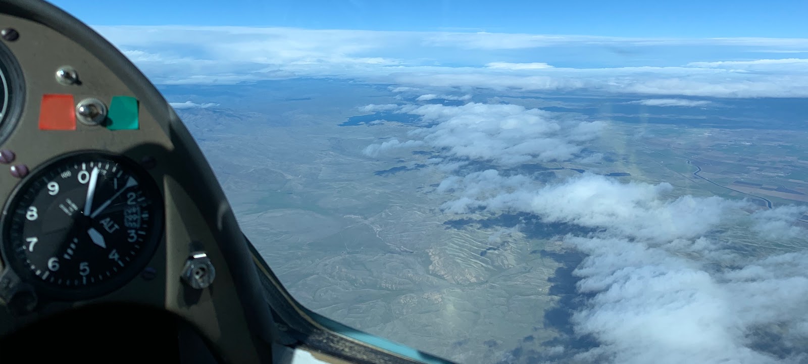
We reached the rain wall a little bit north of Belridge. It towered above us with tops well over 25k. To the north was an unbroken sea of clouds with tops in the 13-14k range. Bakersfield was still open to the SE. Beneath us the Foehn gap was nice and clear. There would be no loitering for the front to pass and crossing over the front.

We turned south. The moisture influx was accelerating and the valley was capping over (video). A “good” option was Wasco. I’d checked the day before and found Lyft drivers and it was only about 1 hour drive from Avenal. We would need to run out to an opening, then back to the NW under the cloud deck. Nearing McKittrick for 5th time today we took a climb high to give us options. We still had 50 minutes or so until sunset and lots of options. Wasco seemed reasonable so we headed for a gap in the cloud cover over Shafter airport with a 207kt ground speed.
This is also a point where we could also have stretched this to 1000km. By running back towards Pinos and then out into the Antelope Valley or Mojave I think we’d easily have capped 1000km. But that wasn’t the only point of the flight and I had a work commitment the following afternoon that would have been complicated by a long self retrieve from the desert.
Finding a decent hole, Kemp pulled the boards and we circled down through a hole in the cloud deck directly over Shafter (video). Below the clouds, we actually picked up a little icing, most noticeable on the canopy where it seemed like we had a little fog buildup only to discover it was on the outside. We didn’t go through any visible moisture, but definitely had a thin ice on our super cooled canopy.
I took over at this point (video) and thankfully the ice ablated within a minute and we had a clear view of Wasco in the distance. We arrive with 3,000 ft and could not figure out the wind direction.
So began the search for flags or windsock (video). Over town to the high school, back to McDonald’s, down to the middle school. What is up with nobody flying flags? Back over the airport a bit above pattern, we could finally make out the limp windsock. Showing only a few knots of wind favoring runway 12. I set up for a high left downwind for 12 and an uneventful landing with a rollout to the end of the runway (video).
Out of the glider and hobbled by frozen feet, it was +4 to -4F most of the flight, Kemp finds the tie downs. I spun the glider and we pushed it towards the cables about 300ft away. As we reached the cables, the gust front hits. Dust and tumbleweeds lead the charge and in seconds, rain.
Kemp wisely suggested pushing the glider into the lee of the hangar and we tucked in as tightly as we could as the surface gusts were in the 40kt range (video). Now getting drenched despite sheltering under the wing, the winds began to subside a bit, but the rain continued.
With winds manageable, we secured the glider to the tie-down cables and looked for exit options. The gate was electric, closed, with no walk-thru gates to be seen. We then summoned a ride. Uber - Nothing. Lyft - nothing. So much for that plan. My research the day before showing a Lyft driver was proven to be an anomaly. Sheepishly I called Dan Gudgel to see if he might be willing to come rescue us. Thankfully, he had already discussed this option with Julie and agreed to the task. We had about an hour to figure out how to get out of the airport.
We walked down to an office building with a couple of lights on and found nobody there. Every sign with a phone number, we tried calling. Airport manager, caretaker, crop dusting businesses, fuel number, other manager numbers. We called and left messages where we could and got several “this number has been disconnected or is no longer in service.” Kemp called 911 since the non-emergency line at the Sheriff was unattended.
Kemp: 911 got me to the Kern County Sheriff’s dept. I said that I had an emergency landing of my glider at the Wasco airport, I’m fine (you need to say this, that is what they are concerned about, no dead bodies on the dispatcher’s watch pls…), and that I needed someone who could open the gate. They said they’d call me back. I moved onto other projects to open the gate. Later, I had several “No Caller ID” calls, and assumed they were robocalls. NOT SO! When you ask the police or sheriff to do something for you, answer *every* call. The calling number is hidden for law enforcement.
They left messages asking about my status and location as they had sheriff cars circling the airport 8^0. I eventually listened to my voicemail, and called the dispatcher back but that was 2 hours later. Whups!
Morgan: I tried a big piece of metal pipe to trigger the gate. No luck. Kemp found a massive steel dolly which we dragged a few hundred feet to the gate. No luck. With the time nearing for Dan to arrive, Kemp managed to climb the fence near the gate, mostly avoiding the barb wire. At the keypad we tried the numbers of unicom, field elevation, pattern height, random numbers. No luck.
When Dan arrived, I hopped the fence and we got on the road for Avenal around 6:50pm. Back at Avenal around 8:00pm, we changed into some dry clothes in the motorhome and ran up the street for Mexican food. A bit before 9pm we sent Dan home with our apologies to Tracy, but thankful for being the hero of the day by towing and retrieving us.
We headed back to Wasco arriving at Walmart around 10:15pm. Pro-tip: If you have a self contained RV, many Walmart locations are open to camping overnight at the far edge of the parking lot. We called it a night and got some much needed rest.
In the morning we had some breakfast and coffee and headed to the airport around 8:00am hoping someone would be working there. On the way, I got a call from Loretta, a sweet 89 year old woman who works for the crop dusting operation at the airport where I had left a message. She assured me that the gate was now open and gave me the code. Then proceeded to give me her home number just in case I ever got trapped there again. If I called her, she’d find someone to come get me out.
The gate indeed was open and we positioned the trailer to begin the derigging process. The cold front had indeed been cold. The wings were still covered in ice from the night.
Sloughing off ice and ice water was a painful way to start. Finally we got the glider dry enough to pull it apart while chatting with one of the crop duster employees Roberto, another nice and helpful person.
The glider was back in the box and I was on the road before 10:00am trying to get back to San Luis Obispo for work and a meeting I had scheduled at 1:00pm.
Kemp was going to take the scenic route home via the Temblors (in the distance) which were now covered in snow following the frontal passage.
Planning for an 11 hour flight (vs. this 8 hour flight) possible by mid-Feb, the 3 extra hours equals at least 300km more by flying into the Antelope Valley wave out to Big Bear, then tracking back to a landing at Bakersfield.
1250km from Avenal is next !
STATS (OLC)
915.8 km distance
121.3 km/h speed
7.56 hours
Many thanks to Dan Gudgel for towing, data monitoring, pilot retrieval, and moral support!
OLC trace (longest in North America that day)
More Photos from the flight
https://photos.app.goo.gl/dQo3tVDD1SDMW6EW9
Morgan Hall and Kempton Izuno
 |
| Jan 16, 2020, 1:00pm |
Seeing it coming
January 7th 10:46am
Kempton is texting me that he sees a super day for southwest wave out of Paso Robles on Thursday the 16th. Coastal range should trigger enough wave to access it from relatively local to Paso. Nixus happens to be rigged at Paso Robles and might be available. Many hurdles to cross for that to happen though. It's right in the middle of additional flight testing and verification.We agree to watch the forecast and let things firm up. I do block my calendar out at work just in case. I alert Jim Payne and Paulo Iscold about the possibility thinking that Jim may want to use Nixus for a flight. If not, I am hoping it will be available.

Then we wait. Will it improve, degrade stay on track?
Kemp: Morgan and I had known each other for years but never flew together. With many years of mentoring cross country pilots in each of our two seat ships, we were keen to figure out a time to fly this season. At my base at Williams, I look 16 days out for possible setups for long flights, then around 7 days out, start alerting other pilots to the possibilities. I’d been watching since early November for a wave day along the southern Diablos and Temblor range for a 1000K zig-zag. For Jan 16th the 700mb setup was near ideal, with 40kt winds at 11,000 ft. from 240.
Sunday January 12th, 3:59pm
Forecast has shifted. Now Wednesday afternoon is looking best. Kemp has the front speeding up and passing through mid morning on Thursday with rain early. Looks like this may not happen.
Kemp: Glider pilots enduring a forecast’s ups and downs is called “weather whiplash” 8^)
Tuesday January 14th
Narrowing in that my Duo is the most likely choice for this attempt. Nixus may be available, but requires more coordination, ground support, prep-work and timelines are already looking tight. Paso Robles isn’t showing any wave overhead and it is looking to be overcast and wet.
We are both thinking along the same lines for tasking at this point. It will be a yo-yo flight, that’s a given. We will press as far north on the first leg as we can. Probably Los Banos area and then when we hit the rain wall, we will turn south. The forecast on SkySight made it look as though stepping out into the Mojave and Antelope Valley might be realistic.
Forecast is still looking quite wet, but the front is slowing and we are seeing it move back towards Thursday, but wet. Rain on the ground at Avenal by 1:00pm per NWS. Still pretty unlikely that this is going to come together.
This is an exploration flight that Kemp wants to do. The theory says it should all work, but we need to connect the dots, figure out the jumps between wave systems, map out our options. So even if it is time limited due to wet weather, it’s worth a try. I email Dan Gudgel for a tow.
Kemp: With a 10 hour day, I propose a 625sm task:
- 84sm Avenal CA69- Los Banos KLSN
- 220sm KLSN - Fox KWJF
- 115sm KWJF - Wonderful Pistachios 2CN4
- 90sm 2CN4 - Quail CL46
- 116sm CL46 - CA69

Wednesday January 15th
Less than 24hrs out, the forecast on the ground looks uninspiring to me. Rain in the Avenal area by 1:00pm. West of Avenal looking like solid cloud cover. Valley getting a fair bit of rain (.25”+) and a strong front. I run a briefing in Foreflight for the intended route. Airmets galore. Mountain Obscuration, Turbulence (That’s actually a good one) and Icing. IFR along much of the route during the forecast time. Surface conditions in the afternoon are also forecast to be MVFR or IFR for most of the Valley. Great, let’s go.
I get confirmation from Dan that he is available to tow early on Thursday if we decide to go. He says the storm is going to come ashore harder than forecast though (and he will be proven right). This type of front intensifies as it approaches the coast and the Hanford NWS is under-predicting the rain amount. Hah, I thought the forecast as of Wednesday was wet and my valley weather god is telling me that it wasn’t pessimistic enough.
I’m scrambling to put out a few fires at work, shift some meetings and get home to pack up a few final things into the RV and get on the road with 5H in tow.
Kemp: Looking at the SkySight rain chart I’m thinking, “this isn’t so bad”. How wrong I'd be! For those new to wave weather, this is prefrontal wave, as we're taking advantage of the increasing winds ahead of the front, ideal for wave, while managing the risk of rain and the bad weather of the front itself. Ideally the front stalls in the morning to allow us steady, nice wave all day, but that clearly was not the case here.
Morgan and I meetup finally at Paso Robles at 7:00pm as I drove from the north, and he from the south. We assemble at Avenal in calm conditions with Morgan remarking, ”it’s strange, how calm it is through the morning of a wave day here”. Well, the banging of the winds at 1:45am drove him to quickly re-secure the ship. Me, I slept through it 8^0
Morgan: Famous last words, “It doesn’t usually blow until mid morning…” After rigging, prepping and generally securing the glider, I moved on to prep the towplane for Dan. Fuel, oil, battery check, preflight and organizing a tow rope and the appropriate weak links. Everything I could do to ease the job on Dan and make things go quicker in the morning. We were hoping for a 7:10am launch or so.
Cue the rotor touching down at 1:45am rustling the trees and motorhome. The second gust was enough to convince me to better secure the glider. Out of bed and down to the trailer for extra tie-downs, elevator and rudder locks. Back to bed by 2:10am.
Thursday January 16th
Kemp: We wake up before 6:00am with continued gusting that feels like 30 knots or more and the occasional tumbleweed hitting the motorhome. Morgan is not optimistic as we need to get the tow plane out of a hangar whose door does not do well with southerly winds, and then the choice of runway is mostly crosswind. Hey, at least there's no dust!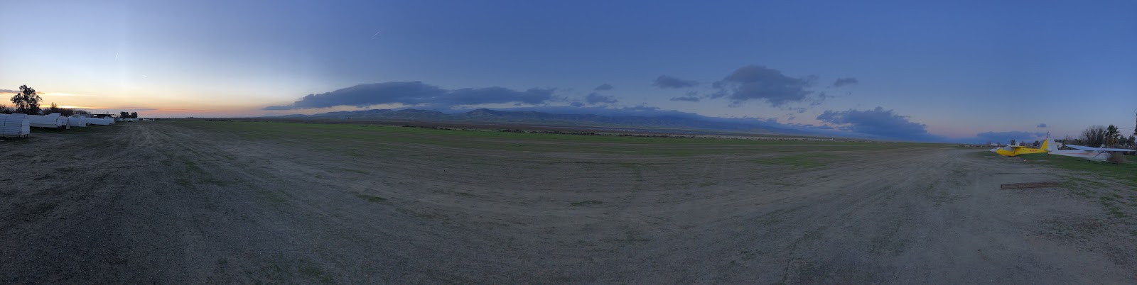
Dan arrives around 6:30am and we discuss our options over coffee while waiting for a bit more light. A departure right at sunrise is ideal, but ensuring we can pull this off safely and not risk ourselves or our equipment is paramount.
A survey of the runways as the sun comes up yields some encouragement. Runway 26 is only about 30 degrees cross. Additionally the winds are a bit more steady the further west you go. It seems that the worst of the rotor was touching down right by the motorhome and the clubhouse.
One last task is to move a couple of trailers from the shade structure. With the winds, Dan will be unable to safely manage the hangar door solo. We need a safe place to secure the towplane and clear that as a final task before moving the trailer and motorhome off the airfield in prep for the coming rain. Avenal becomes a greasy muddy mess with about ¼” of rain and any aircraft or vehicle movement causes serious ruts.
Leg 1 Avenal to San Luis Reservoir
Morgan: This is the first wave climb I’ve had in a few years that is this strong. No milking 1-2kt lift and being excited with 3kts. Only two short beats and we’re established in laminar flow and on the first leg. My intention was to run up the primary for adequate altitude to drop over the back towards Coalinga. Nice to be off and running immediately, climbing and covering ground. |
Looking north towards Coalinga about to drop downwind. Wind is bottom to top.
|
Our first downwind jump came 20 minutes after release at 11,400 ft. upwind of Coalinga. Beautiful bars set up over Los Gatos Creek (the valley that leads from Coalinga to Hernandez reservoir) and beyond the San Benito Mtns north of Coalinga. The line behind Wright Mountain looked really strong, but we wanted to mark the wave bar over Los Gatos Creek for reference.
 |
Looking NW towards Panoche (in the clear area, middle left). Wind L to R.
|
A short dogleg on Los Gatos Creek and it was over the back towards the Idria Valley. This extended to Panoche with at least two more bars downwind towards the Panoche Hills and I5. Winds were in the 60-70kt range, but we managed 60kts+ over the ground most of the time.
As we approached the turn, I couldn’t help but tease Ramy a bit knowing his FOMO (Fear Of Missing Out) meter was off-scale. Typically the rest of the flying community is watching Ramy extracting the most out of a day midweek while we tend to work. Thankfully InReach messages allow a few jabs from 14,000 ft. when data coverage is spotty.
Leg 2: San Luis Reservoir to Maricopa
Turning south (video) we retraced our steps as the wave bars built stronger out in front of us towards Coalinga. With the approaching front, the wind strength was increasing and the bars shifting further downwind.

The jumps upwind (video) were expensive. With as much as 70kts on the nose it cost 4,000 ft to cross the sink and clear the top of the wave bar to reach the lift. We were always looking out 10-20 minutes down our flight path. Where we’d cross, what looked strong, where were the bars highest or with the steepest leading edge.
Our goal was to fly as fast as possible, but reaching our next jump point at 16,000 ft or so in order to have adequate altitude to cross. That’s the guesswork and math problem you’re continually working out. How fast can I fly so I don’t have to stop.
In general, we were typically on the same page. Looking towards the same features in the wave for the jump. Bridges connecting wave bars, channels in the clouds, anything that indicated a potential energy line. Kemp definitely got me flying faster than I’m used to. With such strong lift and winds we were often running at 100kts or more which is well above the point where the Duo polar drops off a cliff.
Nearing Harris Ranch and Coalinga, we had two jumps to make to get back to the primary. The first was costly with nearly 6,000 ft lost as Kemp pushed hard into increasing winds (video). We only slowed slightly to regain 5,000 ft and I used all of that in the next jump. Arriving in the lee of Black at around 10,000 ft I slowed us for a near vertical climb at 8kts+. The next segment looked soft. The hills southeast of Avenal are lower and less abrupt than what we’d been working. The next solid looking line was near Highway 46 and Blackwell Corner about 30nm away. We took the elevator to 17,800 ft to push across the soft area without stopping.
 |
17,800 ft at Black Mountain looking towards the Temblors. Wind R to L.
|
 |
We could see in the distance on track where the rotor touched down creating a small dust storm
|
The Temblors were capped with cloud and the wave off them was working very nicely. Soon we were back at 100kts racing for the end of the marked bar. Ahead towards Taft it was blue. There was a strong haze layer tucked up against the hills and what appeared to be rotor cu down near Maricopa. We had altitude to explore and SkySight predicts wave to continue. We found generally friendly air, but no significant energy line. We explore a bit over the rotor cu and on closer inspection, they’re motionless (video). No telltale twisting or motion and no wave on top of them. A brief search to the “red” zone predicted by SkySight on XCSoar yield no results. We turn north.
Leg 3: Maricopa to Coalinga
 |
Over Taft Looking NW 12:45p. Wind L to R.
|
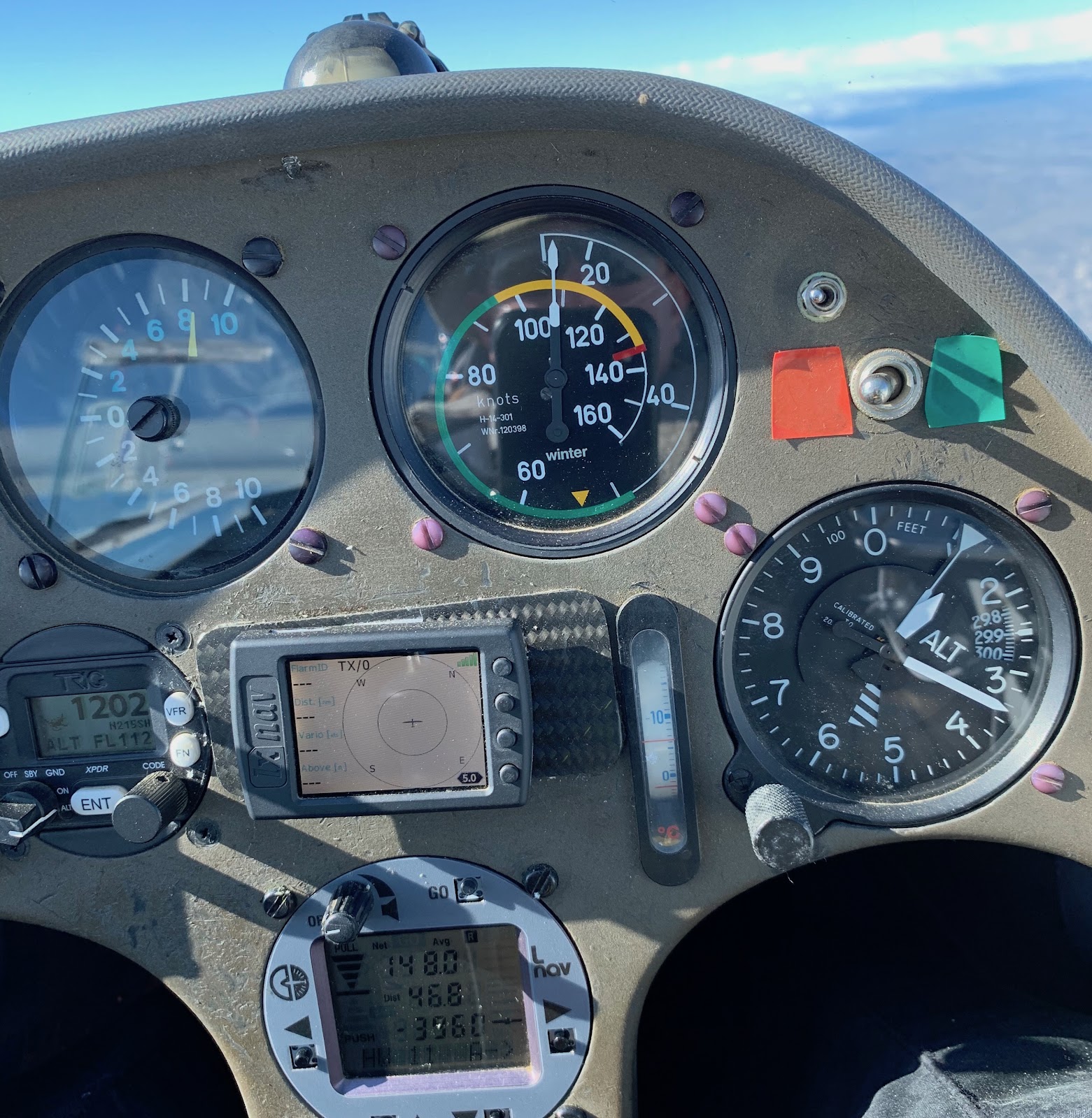 |
108kts indicated with 14kts Netto and a net average climb of 8kts.
|
We more or less retraced our steps along the bar, finding a bit more friendly air in the lee of Orchard Peak as we headed back towards Avenal.
Most noticeable was how far the wave bars had shifted since the morning. The increase in winds, now peaking near 80kts was stretching the wavelength out and moving the bars downwind. Where the line had once been close to Black, as we cross over Avenal and established on that bar, we were a few miles northeast of Avenal in the primary.
 |
Climbing North of Avenal
|
Kemp commented that it’d be a very confusing flight without the marked wave. The movement of the bars was very extreme and we rarely retraced our path exactly. Approaching Coalinga, the front towered above us as we could see rain falling to the west of Coalinga from the lower clouds.
 |
Looking towards Coalinga from Avenal
|
Leg 4: Coalinga to Mt. Pinos
Southbound for the final expected long leg started off similar to the previous southbound segment. The definition to the south had improved so we made a little better time. We also had a more interesting looking line of clouds along the top of the Temblor range (video).
The wave near Belridge was ripping and allowed me to time a near perfect arrival at 17,800 ft and high energy to dive across the Temblors. Reaching the leading edge of that cloud it was working, though not real strong. Turning Southeast it quickly picked up strength.
 |
San Andreas Fault with Mt. Pinos in the distance. Wind R to L.
|
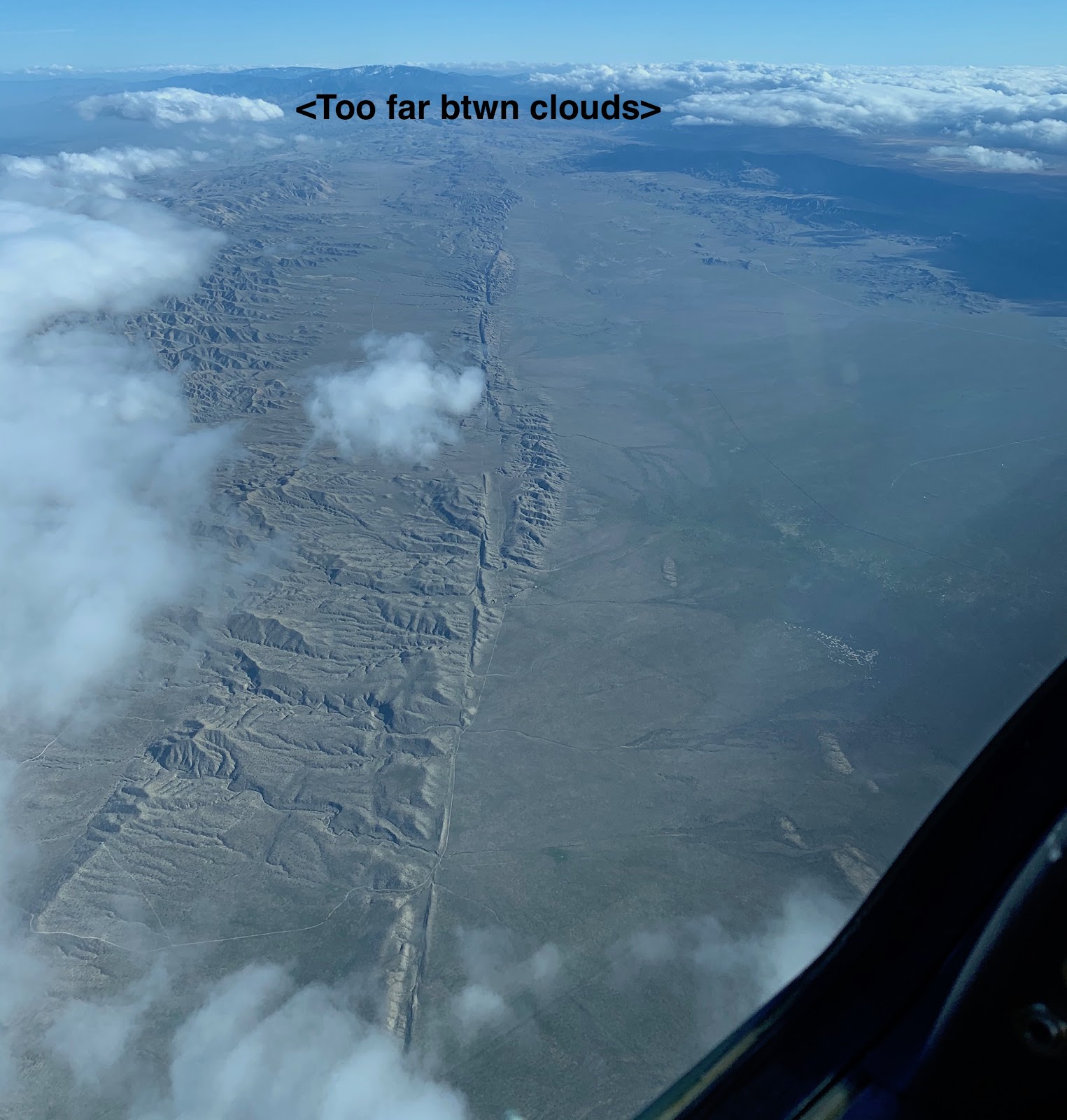
Kemp: In the image above, notice the unusually wide gap between the clouds. With the air mildly turbulent, and the left hand side (downwind) clouds not having any laminar look to them, my theory here is that, for whatever reason, the wind is strong enough to drive the air along the California Valley to the Temblor range without a wave effect. Then the ridge trips the air in a hydraulic jump effect, causing wave-like lift, but it’s not wave. I’ve felt this before when crossing wave gaps also.
As we climb, the air became less turbulent and more wave like. With no obvious line or markers we headed towards Mt. Pinos as a turnpoint maintaining a slow climb.
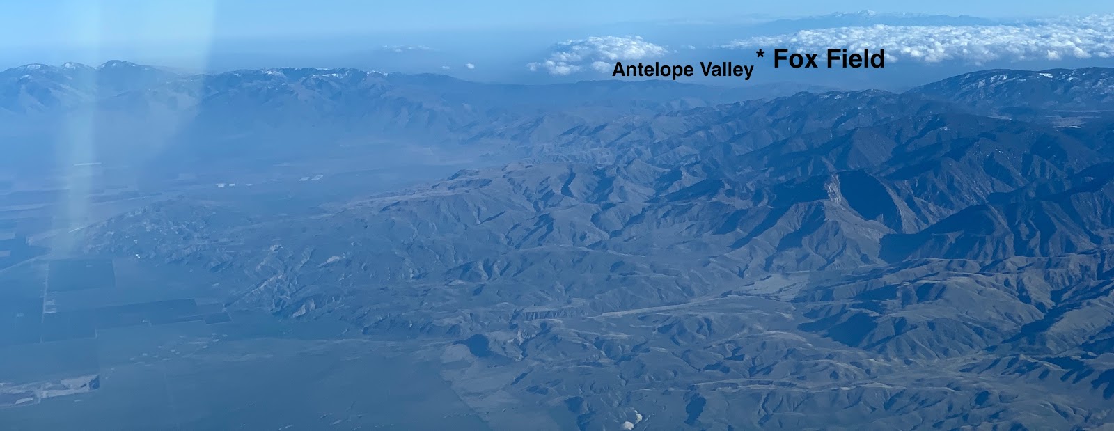 |
Wave marked in the Antelope Valley near Quail Lake seen from near Maricopa, 3:15pm
|
From near Pinos, the Antelope Valley was clearly working and was marked. We could have made the 50nm quartering downwind jump to the wave cloud, but it was a commitment. We’d be at 17k at Fox Field by 4:00pm, for 1 hour to go another 100 nm east, but…we turned Pinos when the lift fell off.
Leg 5: Mt. Pinos to the rain wall
Leg 5 was pretty straight-forward. Retrace our steps up the Temblors wave bar (video) and then jump to the primary around McKittrick. As we progressed, we talked about our options. We had about 1.5hrs of daylight left. Originally the SkySight rain forecast was pretty optimistic and looked like it would clear out quickly. If we could get high and stay high, maybe there would be openings out into the valley and we could return to Coalinga.
Because of the dirt strip at Avenal, we knew that we wouldn’t be able to land there if any measurable rain hit and we were 90% sure on takeoff that we wouldn’t return to Avenal. Coalinga with it’s paved runway was an option. Nearing McKittrick I got a text from Julie. “Avenal about to get hammered.” So we knew that option was definitely gone.
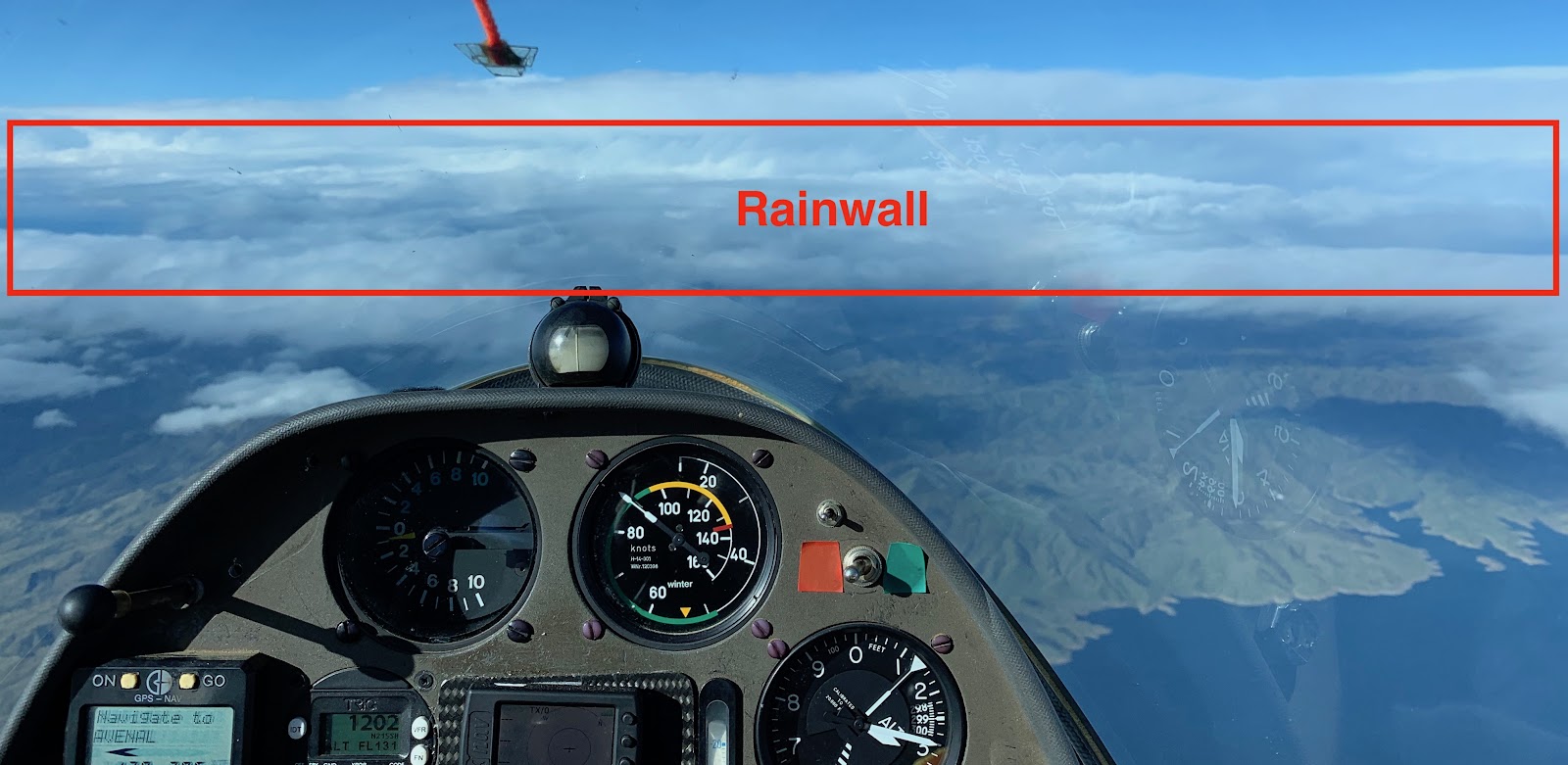
We reached the rain wall a little bit north of Belridge. It towered above us with tops well over 25k. To the north was an unbroken sea of clouds with tops in the 13-14k range. Bakersfield was still open to the SE. Beneath us the Foehn gap was nice and clear. There would be no loitering for the front to pass and crossing over the front.
Leg 6: Getting down safely
This is also a point where we could also have stretched this to 1000km. By running back towards Pinos and then out into the Antelope Valley or Mojave I think we’d easily have capped 1000km. But that wasn’t the only point of the flight and I had a work commitment the following afternoon that would have been complicated by a long self retrieve from the desert.
Finding a decent hole, Kemp pulled the boards and we circled down through a hole in the cloud deck directly over Shafter (video). Below the clouds, we actually picked up a little icing, most noticeable on the canopy where it seemed like we had a little fog buildup only to discover it was on the outside. We didn’t go through any visible moisture, but definitely had a thin ice on our super cooled canopy.
I took over at this point (video) and thankfully the ice ablated within a minute and we had a clear view of Wasco in the distance. We arrive with 3,000 ft and could not figure out the wind direction.
 |
| Kemp: Sh*t, look at that rainwall and gust front coming in, eek! Need in-cockpit doppler to anticipate this, so I see ForeFlight in my future. View W, the large complex is a State prison. |
Out of the glider and hobbled by frozen feet, it was +4 to -4F most of the flight, Kemp finds the tie downs. I spun the glider and we pushed it towards the cables about 300ft away. As we reached the cables, the gust front hits. Dust and tumbleweeds lead the charge and in seconds, rain.
 |
Wasco Doppler 10 minutes after we landed. Notice the gust front dead on Wasco!
|
Kemp wisely suggested pushing the glider into the lee of the hangar and we tucked in as tightly as we could as the surface gusts were in the 40kt range (video). Now getting drenched despite sheltering under the wing, the winds began to subside a bit, but the rain continued.
 |
Kemp as wingstand
|
With winds manageable, we secured the glider to the tie-down cables and looked for exit options. The gate was electric, closed, with no walk-thru gates to be seen. We then summoned a ride. Uber - Nothing. Lyft - nothing. So much for that plan. My research the day before showing a Lyft driver was proven to be an anomaly. Sheepishly I called Dan Gudgel to see if he might be willing to come rescue us. Thankfully, he had already discussed this option with Julie and agreed to the task. We had about an hour to figure out how to get out of the airport.
We walked down to an office building with a couple of lights on and found nobody there. Every sign with a phone number, we tried calling. Airport manager, caretaker, crop dusting businesses, fuel number, other manager numbers. We called and left messages where we could and got several “this number has been disconnected or is no longer in service.” Kemp called 911 since the non-emergency line at the Sheriff was unattended.
Kemp: 911 got me to the Kern County Sheriff’s dept. I said that I had an emergency landing of my glider at the Wasco airport, I’m fine (you need to say this, that is what they are concerned about, no dead bodies on the dispatcher’s watch pls…), and that I needed someone who could open the gate. They said they’d call me back. I moved onto other projects to open the gate. Later, I had several “No Caller ID” calls, and assumed they were robocalls. NOT SO! When you ask the police or sheriff to do something for you, answer *every* call. The calling number is hidden for law enforcement.
They left messages asking about my status and location as they had sheriff cars circling the airport 8^0. I eventually listened to my voicemail, and called the dispatcher back but that was 2 hours later. Whups!
Morgan: I tried a big piece of metal pipe to trigger the gate. No luck. Kemp found a massive steel dolly which we dragged a few hundred feet to the gate. No luck. With the time nearing for Dan to arrive, Kemp managed to climb the fence near the gate, mostly avoiding the barb wire. At the keypad we tried the numbers of unicom, field elevation, pattern height, random numbers. No luck.
When Dan arrived, I hopped the fence and we got on the road for Avenal around 6:50pm. Back at Avenal around 8:00pm, we changed into some dry clothes in the motorhome and ran up the street for Mexican food. A bit before 9pm we sent Dan home with our apologies to Tracy, but thankful for being the hero of the day by towing and retrieving us.
We headed back to Wasco arriving at Walmart around 10:15pm. Pro-tip: If you have a self contained RV, many Walmart locations are open to camping overnight at the far edge of the parking lot. We called it a night and got some much needed rest.
 |
| Glamping at Walmart |
In the morning we had some breakfast and coffee and headed to the airport around 8:00am hoping someone would be working there. On the way, I got a call from Loretta, a sweet 89 year old woman who works for the crop dusting operation at the airport where I had left a message. She assured me that the gate was now open and gave me the code. Then proceeded to give me her home number just in case I ever got trapped there again. If I called her, she’d find someone to come get me out.
The gate indeed was open and we positioned the trailer to begin the derigging process. The cold front had indeed been cold. The wings were still covered in ice from the night.


Kemp was going to take the scenic route home via the Temblors (in the distance) which were now covered in snow following the frontal passage.
Lessons Learned for Morgan
- Sometimes it is good to succumb to peer pressure. The rain in the forecast had me skeptical about what we could get away with. Kemp was very persuasive (Thanks Morgan, it helps that wave can be best right in front of the rain).
- Take the 15 minutes to stake your glider down like it’s safety depends on it. At the very least, your sleep depends on not worrying about it.
- We can do 1000km flights from Avenal in winter. All we would have had to do was go to the desert and committed to a longer retrieve and we’d be 1000k+.
- If you’re going to land out with the hopes of using Lyft or Uber, pick a larger city to land at. Bakersfield would have cost a bit more, but we very likely could have got the ride.
- Better to run a bit further away from the front to give yourself time on the ground. We cut our landing and the gust front arrival too close.
- Prepare, Prepare, Prepare. There were a lot of moving parts coming into this flight. Work, weather, aircraft, tows, field conditions, retrieves. Practice and prepare the things you can control so you can deal with the things you can’t control.
- Commit early, abandon late. If you’re prepared to go, it’s easy, if not saddening to abort. But the added rush of non-commitment until late adds stress and opportunity for mistakes.
- ADS-B In would have been nice for weather picture in Foreflight.
- Having a motorhome is awesome! We had somewhere warm and comfortable right at the field which kept us more rested and prepared for the flight.
Lessons Reinforced for Kemp
Rigorous prep and planning paid off again as many factors came together on the same day:- Winds aloft speed and direction
- Workable ground winds
- Marked wave working all day
- Rain holding off until late in the day
- Ship and crew ready and available for the day before during and after
- Many airports and towns downwind
- All airports are <1000 a="" feet="" have="" huge="" li="" msl="" range="" so="" you="">
Planning for an 11 hour flight (vs. this 8 hour flight) possible by mid-Feb, the 3 extra hours equals at least 300km more by flying into the Antelope Valley wave out to Big Bear, then tracking back to a landing at Bakersfield.
1250km from Avenal is next !
STATS (OLC)
915.8 km distance
121.3 km/h speed
7.56 hours
Many thanks to Dan Gudgel for towing, data monitoring, pilot retrieval, and moral support!
REFERENCES
Doppler radar archives
More Photos from the flight
https://photos.app.goo.gl/dQo3tVDD1SDMW6EW9


Comments
Gary Kemp
Randy Teel
Grants Pass, OR
Have you guys forgotten my phone number?
It's midweek. It's wave. I have a crewcab with a 2" hitch and bed cap.
I spent all afternoon looking at those SW cap clouds behind Fox,
lines of rotor and thought someone should've been using the weather.
You can see my pics from the ground looking southwest of Fox on my Facebook page.
Next time - if you FAIL to use the AV and get those extra kms....
I am gonna come kick some fannies.
Crew - personal Lyft pilot -- resource.
Slightly jealous. I've run the wave VFR-on-top from Avenal to Panoche (verified by watching the VOR flopover on my handheld radio a couple decades ago) on a day that the CCSC Spring contest was called off for honking crosswind. Marty flew his 27 to home. I flew the K21 customer in training "local", landed and tied, and took the trailer home for the 27. Got to drive through the dust rotor-trough you saw.
Not jealous of the cold feet, the pelting chilling rainy tiedown.
Next front - call me for standby. Base station equipped. I know how to find Palm Springs Airport. Silly, silly men.
Lovely sharing by the writeup and teaching.
Biggest of congratulations.
Cindy B
God bless you sir, I will not stop telling the world about your kindness in my life, I am a single mum with kids to look after. My name is Emily Peterson and I am from Convention Center Drive, Miami Beach, FL. A couple of weeks ago My friend visited me and along with our discussion she told me about MR LORENZO DIEGO LOAN FIRM FINANCE, that they can help me out of my financial situation, I never believed cause I have spent so much money on different loan lenders who did nothing other than running away with my money. I have been in a financial mess for the pass 7 months now, She advised I give it a try so I mailed him and explain all about my financial situation to him, he therefore took me through the loan process and gave me a loan of $390,000.00 at a very low interest rate of 2% and today I am a proud business owner and can now take good care of my kids, If you must contact any firm to get any amount of loan you need with a low interest rate of 2% and better repayment schedule, please contact MR LORENZO DIEGO LOAN FIRM FINANCE email:- {mrlorenzodiegoloanfirm@outlook.com}