Gliderpalooza Day 2, May 29th - Around the Horn
The return to Avenal
After an amazing day Saturday with thermals, powerful convergence and wave the unstable weather filled in and rained on us for a good part of the night. The rain wasn't really all that bad. But a combination of factors put that night at the top of Julie and my list for worst camping night ever.
Mercy Hot Springs is a nice place, a little oasis in an obscure valley in between I5 and 101. They had a group camp area in these brushy conifers that seemed like an ideal place to pitch a tent out of the wind. Setting up in the dark, the first bad sign was a bird that wasn't happy with us invading it's territory and was beeping incessantly. Surely it would quiet down once we went to bed. Next were the beetles. Beetles you say? Why yes, think of the movie The Mummy and the floor covered in beetles. Sure, these were smaller and mostly they just covered the trees, but there were thousands and thousands.
After a great soak in the hot tub and a few lies about the days flying most of us headed to bed. Crawling into the tent with my headlamp on, there were a lot of beetles in the tent. Nice! I picked them and threw them out. Then there was the bird. The damn bird that wouldn't shut up. Like a slightly off-beat drummer, it would beep all to regularly, every 20 seconds or so. All night, beep, beep, beep. Then a beetle would climb over my leg, or hand, or face. Beep, beep, beep. And then the dog would shift, grumble, ask to be let out. So our lovely night at Mercy was anything but Merciful. The bird, a long eared owl, finally shut up as the first color hit the night sky. Ahh, quiet.
By 7:00am the skies were clearing and the clouds were ripping overhead with stacked lenticulars visible in many directions. We headed back to Panoche around 10:00 hoping for an early launch into the unknown. By 11:00 the skies were filled with puffy cu racing by. Buzz was the first off in his motor glider taking off into the stiff westerly winds. Ramy, Eric, Shannon and Julie and I pushed down to the east end of the strip and awaited the tow pilot.
After Buzz, Eric launched, then Ramy and Shannon. The West end of the strip has a set of power lines. We wanted to be really sure the Cherokee could get us over the lines comfortably taking off uphill. With about 15mph of wind, it seemed like it wouldn't be a problem. Paul kept the speed on and I flew as efficiently as possible as we raced towards the power lines. Easily clearing them it was still more exciting than a typical launch at Avenal with only a 4ft fence to clear.
Off tow, we connected to a solid 4 knot climb with occasionally stronger punches. Wind drift was considerable with nearly 20mph of winds from the NW. Ramy, Buzz and Eric were already heading out into the San Joaquin Valley headed for Fresno. Reaching cloudbase at around 5500 we pressed east with the nose down in an effort to catch up.
South of Fresno we spotted Buzz. We pushed farther east, while Buzz took a more SE line directly downwind. We crossed around the Class C airspace, well outside of it and pushed on towards Ramy and Eric that were nearing Sequoia field.
As we approach Sequoia, we got out of sync with the clouds. Our easy run was over and it was time to work. The next good looking cloud didn't work. Neither did the next one, or the next one and as we headed to Visalia and backtracked slightly we finally connected with a disorganized climb and spent 10 minutes or so getting back up to 5000. That was enough time for Ramy and Eric to shake us again as they connected with the Sierra Foothills while we were out in the valley 10 miles or so.
By this time our goal was clear and Ramy was on the hunt for a flight "Around the horn" which for us is usually running down the Temblors to the Grapevine and on to the Tehachapi's before connecting to the Sierra. Only this would be the opposite route running down the foothills of the Sierra and around to the west. Unusual yes, but a great task given the strong post frontal conditions. My biggest concern was getting home the 100 miles from the south end of the SJV. We had a 15-20mph NW wind at our backs on the run down, but heading into that was going to be a different story.
For the next hour or so we worked downwind towards Bakersfield and Tehachapi. Never getting really low, but spending more time below 4000 than we cared. Below about 4500 the thermals were more broken and disorganized by the wind. It was definitely best to stay high. Despite having to work to get up a few times, we still covered 90 plus miles fairly quick, but couldn't catch up with Ramy and Eric with their line in the foothills working well.
Crossing over Bakersfield at 5500 and again pushing hard at cloudbase it was bizarre to look down on a big city and a major seeming airport that only 15 minutes before had been a landout option. Having driven through Arvin and up 227 across the base of Bear Mountain for 20+ years going to the Owens Valley, I knew exactly where we were headed to get up. Big huge mountain and face with a stiff NW wind blowing straight into it.
We'd get up there for sure and I didn't stop for any lift as we neared the mountain. Diving into the ridge at 3400 the top was shrouded in clouds, but the face was working. It took a few passes along the face, but very quickly we were nearing cloudbase at 6000 ft. A real treat was the fact that the condensing cloud near the top was snowing and coating the trees on the mountain right in front of us.
Back at cloudbase it was nose down again and heading out to cross the valley and looking for good clouds again.
Crossing 99 and 5 at around 5000 we had a few options for clouds to go to and places to keep within reach for landing. Ramy was ahead and headed for Taft. We'd cut the corner and slipped momentarily in front of Eric, though much lower. Pressing on we were again down in the 3500 range before finding a thermal back above 5000. Eric called a thermal 11 miles out from Taft. We had Taft on glide and headed his way finding that thermal or at least a similar one. Which put us in good shape to reach Taft. Despite a good thermal, we were again low at Taft before finding a strong thermal to 7000.
With that thermal we were able to follow a short street and connect with the Temblor Range where things went well for the next 30-40 miles.
Nearing Blackwell we were getting lower and lower and couldn't connect with a good climb. Eric tried to call us into a good climb over the back of the temblors. Despite searching, I couldn't find it and had to decide if I wanted to commit to landing over on the CA Valley side or heading to Blackwell.
I opted for more convenience and some chance at getting back to Avenal by going towards Blackwell. Weak convergence lift was to be found along the top of the temblors, but every turn resulted in falling out of lift. Finally committing to Blackwell we headed out over the Badwater canyon and about 4 miles out from Blackwell we hit a ripper back to 6000. This put us on a marginal final glide to Avenal at a Macready 0. Given the headwind and the sink we'd been seeing I wasn't confident, but we had enough to get over the top of Orchard Peak where there were some fresher looking small clouds.
It worked and we found a good climb that put us well above glide to Avenal. Despite a healthy pad, the closer to Avenal that we got, the stronger the headwind became. Crossing the ridge I jogged left in the ridge lift for a few seconds to get a better gauge on the winds and also to snag a few extra feet to ensure an easy final glide. We touched down just slightly over 6 hours after rolling on tow and covering 504km on the OLC.
Not an easy flight, but great to have Ramy and Eric dangling like carrots out there to keep me driving to catch them. They managed to make it all the way back to Panoche, another 100km NW of Avenal bringing their flights over 600km. Another amazing day.
Video Recap:
Photo's:
https://picasaweb.google.com/morhall/GliderPalooza2011#
OLC Trace:
http://www.onlinecontest.org/olc-2.0/gliding/flightinfo.html?flightId=1107365069
After an amazing day Saturday with thermals, powerful convergence and wave the unstable weather filled in and rained on us for a good part of the night. The rain wasn't really all that bad. But a combination of factors put that night at the top of Julie and my list for worst camping night ever.
Mercy Hot Springs is a nice place, a little oasis in an obscure valley in between I5 and 101. They had a group camp area in these brushy conifers that seemed like an ideal place to pitch a tent out of the wind. Setting up in the dark, the first bad sign was a bird that wasn't happy with us invading it's territory and was beeping incessantly. Surely it would quiet down once we went to bed. Next were the beetles. Beetles you say? Why yes, think of the movie The Mummy and the floor covered in beetles. Sure, these were smaller and mostly they just covered the trees, but there were thousands and thousands.
After a great soak in the hot tub and a few lies about the days flying most of us headed to bed. Crawling into the tent with my headlamp on, there were a lot of beetles in the tent. Nice! I picked them and threw them out. Then there was the bird. The damn bird that wouldn't shut up. Like a slightly off-beat drummer, it would beep all to regularly, every 20 seconds or so. All night, beep, beep, beep. Then a beetle would climb over my leg, or hand, or face. Beep, beep, beep. And then the dog would shift, grumble, ask to be let out. So our lovely night at Mercy was anything but Merciful. The bird, a long eared owl, finally shut up as the first color hit the night sky. Ahh, quiet.
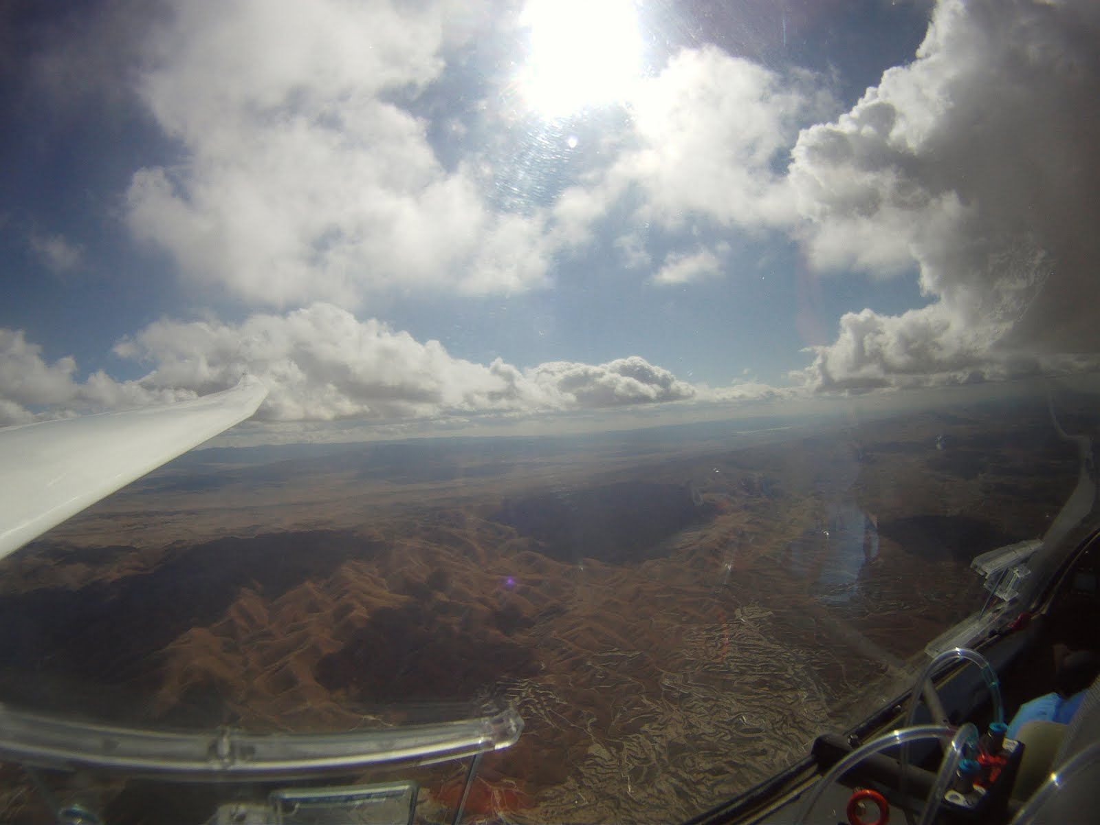
By 7:00am the skies were clearing and the clouds were ripping overhead with stacked lenticulars visible in many directions. We headed back to Panoche around 10:00 hoping for an early launch into the unknown. By 11:00 the skies were filled with puffy cu racing by. Buzz was the first off in his motor glider taking off into the stiff westerly winds. Ramy, Eric, Shannon and Julie and I pushed down to the east end of the strip and awaited the tow pilot.
 |
| Paul returns from towing Shannon into beautiful skies. |
Off tow, we connected to a solid 4 knot climb with occasionally stronger punches. Wind drift was considerable with nearly 20mph of winds from the NW. Ramy, Buzz and Eric were already heading out into the San Joaquin Valley headed for Fresno. Reaching cloudbase at around 5500 we pressed east with the nose down in an effort to catch up.
 |
| Julie checks the sectional to confirm FAT Class C Airspace. |
 |
| Over the agriculture near Selma. |
By this time our goal was clear and Ramy was on the hunt for a flight "Around the horn" which for us is usually running down the Temblors to the Grapevine and on to the Tehachapi's before connecting to the Sierra. Only this would be the opposite route running down the foothills of the Sierra and around to the west. Unusual yes, but a great task given the strong post frontal conditions. My biggest concern was getting home the 100 miles from the south end of the SJV. We had a 15-20mph NW wind at our backs on the run down, but heading into that was going to be a different story.
 |
| Drier fields as we near Bakersfield. |
Crossing over Bakersfield at 5500 and again pushing hard at cloudbase it was bizarre to look down on a big city and a major seeming airport that only 15 minutes before had been a landout option. Having driven through Arvin and up 227 across the base of Bear Mountain for 20+ years going to the Owens Valley, I knew exactly where we were headed to get up. Big huge mountain and face with a stiff NW wind blowing straight into it.
 |
| Approaching Bear Mountain to the NW of Tehachapi |
 |
| Snow dropping out of the condensing upslope winds. |
Back at cloudbase it was nose down again and heading out to cross the valley and looking for good clouds again.
Crossing 99 and 5 at around 5000 we had a few options for clouds to go to and places to keep within reach for landing. Ramy was ahead and headed for Taft. We'd cut the corner and slipped momentarily in front of Eric, though much lower. Pressing on we were again down in the 3500 range before finding a thermal back above 5000. Eric called a thermal 11 miles out from Taft. We had Taft on glide and headed his way finding that thermal or at least a similar one. Which put us in good shape to reach Taft. Despite a good thermal, we were again low at Taft before finding a strong thermal to 7000.
 |
| Saying goodbye to Taft |
 |
| Converging on the Temblors NW of Taft. |
Nearing Blackwell we were getting lower and lower and couldn't connect with a good climb. Eric tried to call us into a good climb over the back of the temblors. Despite searching, I couldn't find it and had to decide if I wanted to commit to landing over on the CA Valley side or heading to Blackwell.
 |
| Eric high overhead, where I'd rather have been. |
It worked and we found a good climb that put us well above glide to Avenal. Despite a healthy pad, the closer to Avenal that we got, the stronger the headwind became. Crossing the ridge I jogged left in the ridge lift for a few seconds to get a better gauge on the winds and also to snag a few extra feet to ensure an easy final glide. We touched down just slightly over 6 hours after rolling on tow and covering 504km on the OLC.
Not an easy flight, but great to have Ramy and Eric dangling like carrots out there to keep me driving to catch them. They managed to make it all the way back to Panoche, another 100km NW of Avenal bringing their flights over 600km. Another amazing day.
Video Recap:
Photo's:
https://picasaweb.google.com/morhall/GliderPalooza2011#
OLC Trace:
http://www.onlinecontest.org/olc-2.0/gliding/flightinfo.html?flightId=1107365069


Comments