Santa Ynez North Wave in Winter 1-16-2011
A recap of a great day of Wave Flying out of Santa Ynez. Initially I wrote this as an email to my hang glider friends, so it has a slight skew towards specifics that our local hang glider community is tuned into.
Many years ago, before the Perryometer (the name of our weather station, implemented and maintained by Perry) was up and operational out at Plowshare peak and long before XCSkies, RASPs and other localized weather resources, we used to just make the drive to Plowshare and see what we found. I can remember a lot of days where we got to launch and found it blasting to 45mph up the face. Maybe something that Patrick would now tackle with a speedwing, but generally it resulted in a lot of hang waiting and quite a few days of driving down the hill and heading home.


Many years ago, before the Perryometer (the name of our weather station, implemented and maintained by Perry) was up and operational out at Plowshare peak and long before XCSkies, RASPs and other localized weather resources, we used to just make the drive to Plowshare and see what we found. I can remember a lot of days where we got to launch and found it blasting to 45mph up the face. Maybe something that Patrick would now tackle with a speedwing, but generally it resulted in a lot of hang waiting and quite a few days of driving down the hill and heading home.
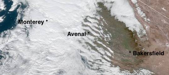
Sunday I had the opportunity to taste a new variation of that day. The RASPs were forecasting strong N winds up high and predicting wave in the Santa Ynez area with wave bars off the Sierra Madre as well as down near Pine and out towards the Grapevine. The RASP below is cut off right about at the Santa Ynez airport, I didn't capture the Santa Barbara RASP image unfortunately. You can see the various wave bars predicted in red at around 5000ft though.
 |
| Avenal RASP courtesy of Alex Caldwell |
I got a bit later start than I should have, but got the Duo rigged at Santa Ynez by about 12:30. Unfortunately we decided to push out for our tow when the operators had left for lunch. Then when they got back, they had a commercial ride to give. So it was after 1:30 before we actually got in the air. I flew with a Santa Barbara pilot that was out of BFR and therefore couldn't fly in his own plane. It was good for me to have someone with some experience in the wave in that area to point out landmarks and usual good spots. I'm familiar with the Cuyama valley, but this was a new view on things.
We towed to the NE towards Figueroa and released at 4600 in turbulent lift. We were on the edge of the wave in the rotor. A couple of jogs and turns in rotor lift and we connected to the laminar flow at around 5000ft I think. Once in the wave it was smooth sailing and solid 5-7knot lift.
Climbing through 8000 or so we had a Cessna pass underneath us, right to left, about 500ft below. Close enough to hear the engine. I had left the transponder in Standby Mode while we were on the ground and forgot to have Greg switch it to ALT. Note to self. Update my damn Checklist! The transponder can't help if it isn't in the right mode. Who knows if the Cessna was using flight following, but it was closer than I care to be with traffic I'm not communicating with and he came out of an area of sky at the edge of our visual scan.
 |
| Heading East around 10K. |
We worked lift behind Fig to about 10 or 11k and then headed east. We connected with strong lift behind Mckinnley and San Rafael. San Rafael is a 6600ft peak and we found a place where I believe two wave bands were interfering with each other, only in a positive way. There was rough air on the edges of a small area, but in the right spot we were averaging 11knts(1100fpm) climb. We took this to 14k and headed east towards Pine mountain.
We didn't find much out near Hwy 33 and Pine so at about 30 miles out from Santa Ynez we turned around and headed west. We climbed back to 13k again in the strong lift and then dove to the North towards the Cuyama Valley. We connected with a secondary wave band half way between Figueroa and McPhereson Peak. Then a few miles upwind of there and a couple miles downwind of the ridge we found the primary (I think). It wasn't terribly strong. 3-4knots, but smooth and consistent. Oppressive fog filled the San Juaquin valley like an overfilled bathtub with wisps spilling over in low spots. Soda Lake, normally white and dry, was an actual lake and we could get a slight sense of wind direction off it. Not something I'm used to doing aside from dust devils of course.

We headed west along the Sierra Madre until somewhere around Cottonwood Canyon where we ran out of wave lift. The air was pretty dead and at least wasn't sinking. We pushed a bit farther west before turning around and heading back towards McPhereson. From behind McPhereson we dove back over San Raphael to our strong climb area from before and found it working even better than before. I took us to over 16k in that climb before heading east again. We were able to press east and this time found lift behind Cuyama Peak. There was only a slightly dead gap crossing towards Pine. Another glider, Thorsten, was already down at Pine at around 14k and was showing lift. We were nearly 17k and kept heading his way. He turned around about 50 miles out from Santa Ynez. Being higher and in lift, I pressed on until a little over 62 miles out before we turned around. (Still got beat on the OLC by Thorsten, of course he was lower and deserved the "win").

At this point we had a great view (if there is such a thing) of the San Fernando valley, the sky scrapers of LA, all of the channel islands and a few jets in our vicinity as they headed into LA or Burbank. We turned and headed west. We had just a little over 1 hour until official sunset so the run north was about covering ground, not getting high. We peaked at about 17600 a bit east of Pine and then just pressed westward covering ground at about 80mph.
 |
| Cachuma Reservoir and San Miguel Island basking in a little California Gold. |
Back at San Rafael I had Greg dive over the back to the Sierra Madre again. I was hoping to run as far NW as possible timing our final glide back to Santa Ynez with just enough time to get down before dark. We flew in wave along the Sierra Madre range. Again it petered out around Cottonwood.
 |
| Looking down on the Sierra Madre Range from the south of Timber Top Peak. |
Closer to Timber Top we picked it up again and it extended up past Plowshare Peak at 10k or so. If it had been earlier in the day I think we could have jumped up a wave band onto the Caliente Range and ran that all the way to Black mountain behind Santa Margarita. As it was, we needed to time our retreat and so at 166 near the ranger station, we turned and started a 30 mile final glide back to Santa Ynez at 110knots. With the tailwind we were initially covering ground at over 160mph. We were loosing our padding on the glide back so we slowed to 100knots to keep a little extra altitude in the bank in case we hit bad sink from the wave. As it was we got back about 1000ft too high and I had to kill off a little height with the spoilers before entering the pattern. We touched down at 5:08 I think. 3 minutes or so before official sunset. Perfect timing essentially.
It was definitely a unique experience to get to see the wave and the interaction with the Caliente, Sierra Madre and other ranges that I don't know the names of. I'm convinced that there have been times when people have reported "glass offs" or other phenomenon out in the valley that were probably wave off the Caliente. Winds aloft weren't particularly high. Maybe 30mph at altitude, not outrageous though and not entirely outside the realm of HG performance.
Pictures, nothing special, but a few:
OLC Trace:


Comments